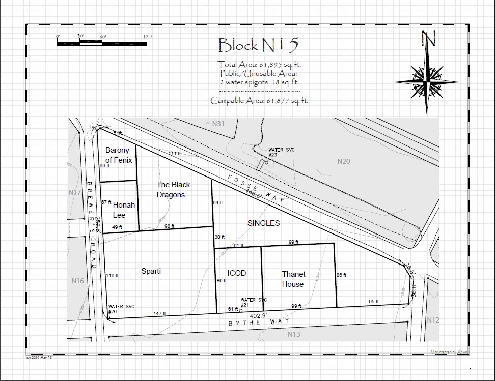
I thought perhaps a visual example might help..
By way of example allow me to show you a map that meets requirements – sort of a “what we’re after here””
Boundaries are clearly marked
Each group name is clearly marked
Singles camping is clearly marked
The approximate length to nearest foot of each border is numbered
Note that the map does NOT include land agent names (modern or SCA)
The map does NOT include square footage or any other additions
Please keep in mind:
While we need the measurements of the borders, we do not want “dimension lines” (they clutter things up too much)
EMS and Event safety need to use these maps to quickly find camps and the visual clutter added by multiple dimension lines (and 106 different blocks worth of interpretations of how to implement that) can really add to “cognitive load” and cost precious time (in the case of EMS needing to locate a camp) so we want the maps to be as accurate, clean and readable as possible
However we need those border lengths, as the map is the only place the borders and dimensions are recorded – this is used by land in case of the need for arbitration. We also spot check to ensure that groups are not taking more space then they’re allocated.
I will make a separate post with some “counterexamples” But I need to take care there as my goal is NOT to shame people but to help explain what to do and not to do..